
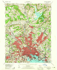
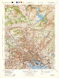
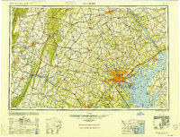
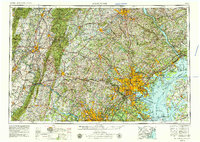
1954 Map of Baltimore
USGS Topo · Published 1954About this map
Baltimore serves as the industrial and logistical heart of this mid-century landscape, radiating a dense network of transit lines across the Chesapeake Bay region. The city's maritime significance is anchored by Fort McHenry and Fort Carroll at the entrance to the Patapsco River, while the surrounding countryside reflects a heavy military footprint at the Aberdeen Proving Ground, Edgewood Arsenal, and Fort George Meade Military Reservation.
Find a feature on this map
223 named features on this map. Tap any name to fly to it.
Don’t see what you’re looking for? This feature index may not catch every label — zoom into the map to look around manually.
Map Details
Editions of this 1954 Baltimore Map
This is the sole edition of this map. No revisions or reprints were ever made.
Historical Maps of Knollwood Donnybrook Through Time
12 maps found
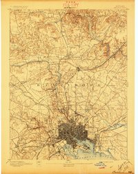
1894 Baltimore
Baltimore City County, MD
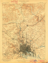
1899 Baltimore
Baltimore City County, MD
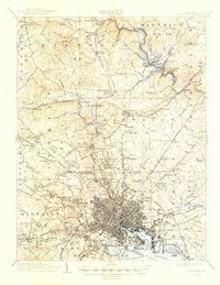
1904 Baltimore
Baltimore City County, MD
1943 Baltimore
Baltimore City County, MD
1944 Baltimore
Baltimore City County, MD
1948 Baltimore
Baltimore City County, MD
1954 Baltimore
Baltimore City County, MD

1956 Baltimore
Baltimore City County, MD
1957 Baltimore
Baltimore City County, MD

1961 Baltimore
Baltimore City County, MD

1984 Baltimore
Baltimore City County, MD

1989 Baltimore
Baltimore City County, MD