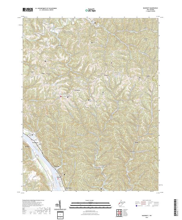
2023 Map of Bancroft
USGS Topo · Published 2023About this map
The Kanawha River serves as the focal point for riverfront development, anchoring a string of riverside communities including Winfield, Hometown, and Bancroft. This landscape transitions from the industry-aligned valley floor to the ridgelines of Grandview Ridge and Crown Hill Ridge. The map reveals a dense network of upland hollows and ridges where small settlements like Confidence and Paradise took root away from the primary waterway. Local genealogy is well-supported by several burial grounds, including the Schowen Cem near Plymouth and the Old Antioch Cem along Wade Chapel Rd. The geography is defined by narrow creek systems such as Eighteenmile Creek and Heizer Creek, which dictate the winding paths of county routes. Notable family-named landmarks like Walter Hoffman Spring and Castro Spring appear throughout the interior, offering specific data points for those tracing regional family history and land use.
Find a feature on this map
111 named features on this map. Tap any name to fly to it.
Don’t see what you’re looking for? This feature index may not catch every label — zoom into the map to look around manually.
Map Details
Editions of this 2023 Bancroft Map
This is the sole edition of this map. No revisions or reprints were ever made.
Other maps of this area

1899 · Charleston
USGS Topo · 1:125,000

1906 · Kenna
USGS Topo · 1:62,500

1906 · Winfield
USGS Topo · 1:62,500

1907 · Kenna
USGS Topo · 1:62,500

1908 · Winfield
USGS Topo · 1:62,500

1909 · Charleston
USGS Topo · 1:62,500

1909 · Saint Albans
USGS Topo · 1:62,500

1931 · Saint Albans
USGS Topo · 1:62,500

1931 · Charleston
USGS Topo · 1:62,500

1933 · Saint Albans
USGS Topo · 1:62,500