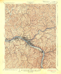
1931 Map of Charleston
USGS Topo · Published 1956About this map
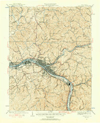
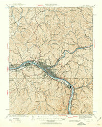
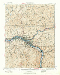
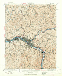
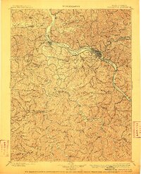
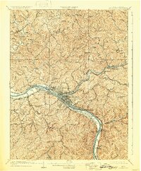
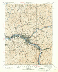
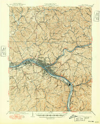
The Kanawha River and Elk River confluence serves as the industrial and civic anchor for this region during the early 1930s. The landscape is defined by a dense corridor of river-dependent activity stretching from South Charleston through Charleston to Marmet, where three major rail lines—the Baltimore and Ohio Railroad, New York Central Railroad, and Chesapeake and Ohio Railroad—converge to transport the area's natural resources. Notable riverside features include Blaine Island and the US Navy Reservation, signaling the strategic importance of the valley.
Find a feature on this map
148 named features on this map. Tap any name to fly to it.
Don’t see what you’re looking for? This feature index may not catch every label — zoom into the map to look around manually.
Map Details
Editions of this 1931 Charleston Map
5 editions found
Historical Maps of Charleston Through Time
10 maps found
1899 Charleston
Kanawha County, WV
1909 Charleston
Kanawha County, WV
1931 Charleston
Kanawha County, WV
1935 Charleston
Kanawha County, WV
1936 Charleston
Kanawha County, WV

1954 Charleston
Kanawha County, WV
1957 Charleston
Kanawha County, WV

1958 Charleston
Kanawha County, WV

1961 Charleston
Kanawha County, WV
1984 Charleston
Kanawha County, WV