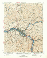
1931 Map of Charleston
USGS Topo · Published 1963About this map
Charleston serves as the focal point of this industrial and transportation corridor along the Kanawha River and Elk River. The 1930s landscape is defined by the convergence of major rail lines, including the Baltimore and Ohio, New York Central, and the Virginian railroads, which facilitated the region's coal and chemical growth. The map reveals the early footprint of neighboring industrial centers like South Charleston and Dunbar, as well as the notable U S Navy Reservation positioned on the river's south bank.
Find a feature on this map
120 named features on this map. Tap any name to fly to it.
Don’t see what you’re looking for? This feature index may not catch every label — zoom into the map to look around manually.
Map Details
Editions of this 1931 Charleston Map
5 editions found

Other maps of this area

1897 · Kanawha Falls
USGS Topo · 1:125,000

1899 · Charleston
USGS Topo · 1:125,000

1900 · Kanawha Falls
USGS Topo · 1:125,000

1901 · Kanawha Falls
USGS Topo · 1:125,000

1906 · Kenna
USGS Topo · 1:62,500

1906 · Winfield
USGS Topo · 1:62,500

1906 · Walton
USGS Topo · 1:62,500

1907 · Kenna
USGS Topo · 1:62,500

1907 · Walton
USGS Topo · 1:62,500

1907 · Clendenin
USGS Topo · 1:62,500