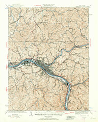
1931 Map of Charleston
USGS Topo · Published 1964About this map
The Kanawha River serves as the industrial and logistical spine of this region during the early 1930s, as depicted in this topography revised by R.C. Seitz and G.A. Mock. The state capital of Charleston and neighboring West Charleston anchor a dense network of river-oriented infrastructure, including the U. S. Naval Reservation and large-scale industrial footprints on Blaine Island. Beyond the primary urban centers, the landscape is defined by the steep, narrow hollows of the Elk River and Pocatalico River valleys, where numerous small schoolhouses like Meyers Sch and Pine Top Sch served isolated rural communities.
Find a feature on this map
128 named features on this map. Tap any name to fly to it.
Don’t see what you’re looking for? This feature index may not catch every label — zoom into the map to look around manually.
Map Details
Editions of this 1931 Charleston Map
5 editions found

Other maps of this area

1897 · Kanawha Falls
USGS Topo · 1:125,000

1899 · Charleston
USGS Topo · 1:125,000

1900 · Kanawha Falls
USGS Topo · 1:125,000

1901 · Kanawha Falls
USGS Topo · 1:125,000

1906 · Kenna
USGS Topo · 1:62,500

1906 · Winfield
USGS Topo · 1:62,500

1906 · Walton
USGS Topo · 1:62,500

1907 · Kenna
USGS Topo · 1:62,500

1907 · Walton
USGS Topo · 1:62,500

1907 · Clendenin
USGS Topo · 1:62,500