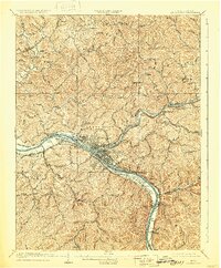
1909 Map of Charleston
USGS Topo · Published 1930About this map
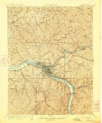
Charleston and its surrounding river valleys dominate this early twentieth-century survey, revealing a landscape defined by industrial expansion and the critical intersection of water and rail transport. The confluence of the Elk River and the Kanawha River serves as the focal point, with the city and its developing suburbs like South Charleston and West Charleston clustered along the banks. Evidence of the region’s coal economy is prominent, specifically at the Mason Station Graham Mines P.O. and within the narrow hollows where settlements like Malden and Dana flourished.
Find a feature on this map
88 named features on this map. Tap any name to fly to it.
Don’t see what you’re looking for? This feature index may not catch every label — zoom into the map to look around manually.
Map Details
Editions of this 1909 Charleston Map
6 editions found

Other maps of this area

1897 · Kanawha Falls
USGS Topo · 1:125,000

1899 · Charleston
USGS Topo · 1:125,000

1900 · Kanawha Falls
USGS Topo · 1:125,000

1901 · Kanawha Falls
USGS Topo · 1:125,000

1906 · Kenna
USGS Topo · 1:62,500

1906 · Winfield
USGS Topo · 1:62,500

1906 · Walton
USGS Topo · 1:62,500

1907 · Kenna
USGS Topo · 1:62,500

1907 · Walton
USGS Topo · 1:62,500

1907 · Clendenin
USGS Topo · 1:62,500