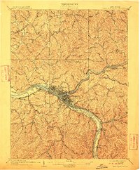
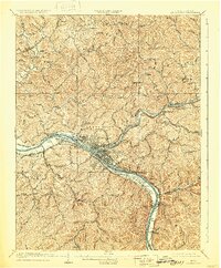
1909 Map of Charleston Special
USGS Topo · Published 1912About this map
Charleston and its surrounding river-valley communities are centered at the confluence of the Elk River and the Kanawha River in this early 20th-century survey. The landscape is defined by the industrial and transport infrastructure of the era, notably the Chesapeake and Ohio RR and the Michigan Central RR which flank the Kanawha. The map captures a moment of transition where established river towns like Malden and South Charleston sit alongside rural hilltop schools and churches, such as the Oak Hill School and Fairview Church.
Find a feature on this map
86 named features on this map. Tap any name to fly to it.
Don’t see what you’re looking for? This feature index may not catch every label — zoom into the map to look around manually.
Map Details
Editions of this 1909 Charleston Special Map
6 editions found

Other maps of this area

1897 · Kanawha Falls
USGS Topo · 1:125,000

1899 · Charleston
USGS Topo · 1:125,000

1900 · Kanawha Falls
USGS Topo · 1:125,000

1901 · Kanawha Falls
USGS Topo · 1:125,000

1906 · Kenna
USGS Topo · 1:62,500

1906 · Winfield
USGS Topo · 1:62,500

1906 · Walton
USGS Topo · 1:62,500

1907 · Kenna
USGS Topo · 1:62,500

1907 · Walton
USGS Topo · 1:62,500

1907 · Clendenin
USGS Topo · 1:62,500