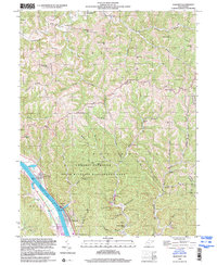
1999 Map of Bancroft
USGS Topo · Published 2000About this map
The Kanawha River serves as the industrial and social backbone of this region, bordering the riverside communities of Hometown, Plymouth, Bancroft, and Black Betsey. This 1999 photo-inspection documents the dense network of ridges and hollows that define the interior, where small settlements like Confidence and Paradise sit along winding routes such as Grandview Road. The landscape transitions from the river-front industry and residential clusters to the expansive Amherst Plymouth State Wildlife Management Area, which preserves a large tract of the local terrain.
Find a feature on this map
63 named features on this map. Tap any name to fly to it.
Don’t see what you’re looking for? This feature index may not catch every label — zoom into the map to look around manually.
Map Details
Editions of this 1999 Bancroft Map
This is the sole edition of this map. No revisions or reprints were ever made.
Other maps of this area

1899 · Charleston
USGS Topo · 1:125,000

1906 · Kenna
USGS Topo · 1:62,500

1906 · Winfield
USGS Topo · 1:62,500

1907 · Kenna
USGS Topo · 1:62,500

1908 · Winfield
USGS Topo · 1:62,500

1909 · Charleston
USGS Topo · 1:62,500

1909 · Saint Albans
USGS Topo · 1:62,500

1931 · Saint Albans
USGS Topo · 1:62,500

1931 · Charleston
USGS Topo · 1:62,500

1933 · Saint Albans
USGS Topo · 1:62,500