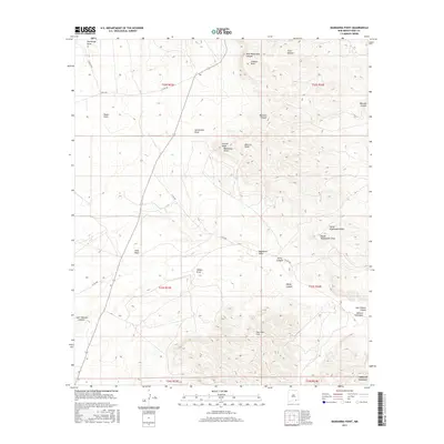
2017 Map of Bandanna Point
USGS Topo · Published 2017About this map
Azotea Mesa and the prominent Bandanna Point anchor this high-desert landscape in Eddy County. The terrain is defined by a complex network of drainage systems, including Beardon Canyon and Last Chance Canyon, which carve through the arid plateaus. The topography reveals significant elevation changes as the land rises toward the Guadalupe Mountains in the south. Unlike more developed regions, the area is characterized by vast open spaces like Bogle Flats and the Sotol Basin, with human presence primarily represented by a sparse grid of rural routes such as Co RD 408. This survey provides a clear view of the hydraulic patterns of the region, from the North Kuykendall Draw to the Wagontire Draw, illustrating how water has shaped the local geography over millennia.
Find a feature on this map
30 named features on this map. Tap any name to fly to it.
Don’t see what you’re looking for? This feature index may not catch every label — zoom into the map to look around manually.
Map Details
Editions of this 2017 Bandanna Point Map
This is the sole edition of this map. No revisions or reprints were ever made.
Other maps of this area

1940 · Bandanna Point
USGS Topo · 1:62,500

1940 · Carlsbad Caverns West
USGS Topo · 1:62,500

1943 · Carlsbad Caverns West
USGS Topo · 1:62,500

1943 · Bandanna Point
USGS Topo · 1:62,500

1943 · West Carlsbad
USGS Topo · 1:62,500

1945 · West Carlsbad
USGS Topo · 1:62,500

1945 · Carlsbad Caverns East
USGS Topo · 1:62,500

1947 · Carlsbad Caverns East
USGS Topo · 1:62,500

1954 · Carlsbad
USGS Topo · 1:250,000

1958 · Carlsbad
USGS Topo · 1:250,000