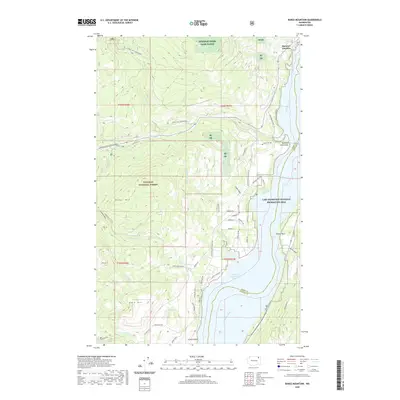
2020 Map of Bangs Mountain
USGS Topo · Published 2020About this map
Colville National Forest dominates the high ground west of the Columbia River in this survey of northeastern Washington. The landscape is defined by the sharp transition from the mountainous timberlands of Bangs Mtn and Bald Hill down to the shores of Franklin D Roosevelt Lake. Along the waterway, local history is preserved in names like Rickey Rapids and Haag Cove, while the northern reaches show the intersection of the Sherman Pass Scenic Byway and Barney's Junction.
Find a feature on this map
69 named features on this map. Tap any name to fly to it.
Don’t see what you’re looking for? This feature index may not catch every label — zoom into the map to look around manually.
Map Details
Editions of this 2020 Bangs Mountain Map
This is the sole edition of this map. No revisions or reprints were ever made.
Other maps of this area

1936 · Marcus
USGS Topo · 1:96,000

1942 · Marcus
USGS Topo · 1:125,000

1948 · Sherman Peak
USGS Topo · 1:62,500

1948 · Kettle Falls
USGS Topo · 1:62,500

1950 · Inchelium
USGS Topo · 1:62,500

1951 · Sherman Peak
USGS Topo · 1:62,500

1951 · Kettle Falls
USGS Topo · 1:62,500

1952 · Twin Lakes
USGS Topo · 1:62,500

1954 · Okanogan
USGS Topo · 1:250,000

1958 · Okanogan
USGS Topo · 1:250,000