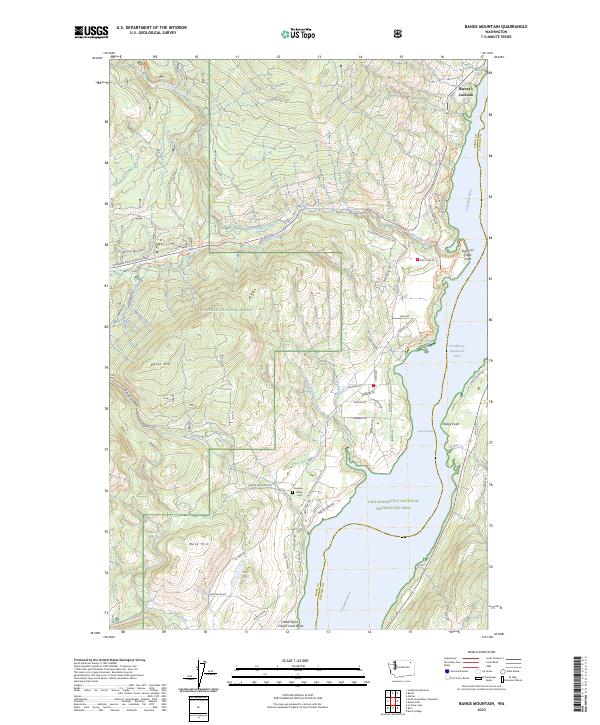
2023 Map of Bangs Mountain
USGS Topo · Published 2023About this map
Franklin D Roosevelt Lake and the Columbia River define the eastern boundary of this Ferry County landscape, where the water meets the steep slopes of the Colville National Forest. The transition from the riverbank to the high peaks is marked by the Sherman Creek Game Range and numerous drainage systems like Roper Creek and Martin Creek. Local history is anchored by the Garden Valley Cem near the junction of Inchelium Kettle Falls Rd and Bangs Mountain Rd, while the northern reaches include the small settlement of Barney's Junction. The terrain rises sharply toward Bangs Mtn and Bald Hill, with the Sherman Pass Scenic Byway providing access through the rugged timberland. The shoreline of the Lake Roosevelt National Recreation Area is dotted with landmarks like Rickey Point and Sherman Creek Point, illustrating the area's importance for both conservation and managed forestry.
Find a feature on this map
66 named features on this map. Tap any name to fly to it.
Don’t see what you’re looking for? This feature index may not catch every label — zoom into the map to look around manually.
Map Details
Editions of this 2023 Bangs Mountain Map
This is the sole edition of this map. No revisions or reprints were ever made.
Other maps of this area

1936 · Marcus
USGS Topo · 1:96,000

1942 · Marcus
USGS Topo · 1:125,000

1948 · Sherman Peak
USGS Topo · 1:62,500

1948 · Kettle Falls
USGS Topo · 1:62,500

1950 · Inchelium
USGS Topo · 1:62,500

1951 · Sherman Peak
USGS Topo · 1:62,500

1951 · Kettle Falls
USGS Topo · 1:62,500

1952 · Twin Lakes
USGS Topo · 1:62,500

1954 · Okanogan
USGS Topo · 1:250,000

1958 · Okanogan
USGS Topo · 1:250,000