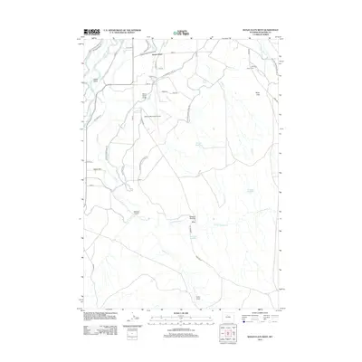
2012 Map of Banjo Flats West
USGS Topo · Published 2012About this map
Big Horn Canal and its associated road networks define the agricultural landscape east of the Bighorn River in this 2012 study of Washakie County. The map details an intricate irrigation system including Coutis Ditch, the Upper Hanover Canal, and the Lower Hanover Canal Rd, which sustain the high-desert settlements of South Flat and the surrounding ranchlands. To the east, the terrain transitions into the more arid Banjo Flats, where the Banjo Ranch sits near the headwaters of Sage Cr and Little Slick Cr.
Find a feature on this map
45 named features on this map. Tap any name to fly to it.
Don’t see what you’re looking for? This feature index may not catch every label — zoom into the map to look around manually.
Map Details
Editions of this 2012 Banjo Flats West Map
This is the sole edition of this map. No revisions or reprints were ever made.
Other maps of this area
1945 · Kirby
USGS Topo · 1:62,500
1946 · Kirby
USGS Topo · 1:62,500
1951 · Schuster Flats SE
USGS Topo · 1:24,000
1955 · Cody
USGS Topo · 1:250,000
1955 · Thermopolis
USGS Topo · 1:250,000
1955 · Sheridan
USGS Topo · 1:250,000
1955 · Arminto
USGS Topo · 1:250,000
1958 · Cody
USGS Topo · 1:250,000
1958 · Thermopolis
USGS Topo · 1:250,000
1958 · Sheridan
USGS Topo · 1:250,000