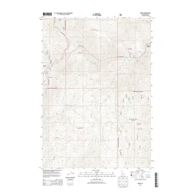
2013 Map of Banks
USGS Topo · Published 2013About this map
Banks sits at the dramatic confluence of the North Fork Payette River and the main Payette River, serving as a critical junction for mountain travel in Boise County. The settlement is defined by its position along State Hwy 55 and the Horseshoe Bend Rd, providing access to the sprawling Boise National Forest and the recreational Banks Campground. The landscape is dominated by significant elevation changes, from the river valleys up to the heights of the North Fork Range and Charters Mtn. To the east, the map captures the western edge of Garden Valley, connected by the Banks Lowman Rd. This 2013 survey illustrates the modern layout of rural infrastructure, including localized access points like Church Ln and Hulls Ln, while tracing the numerous drainages such as Fleming Cr and Pumpkin Cr that carve through the timbered highlands.
Find a feature on this map
35 named features on this map. Tap any name to fly to it.
Don’t see what you’re looking for? This feature index may not catch every label — zoom into the map to look around manually.
Map Details
Editions of this 2013 Banks Map
This is the sole edition of this map. No revisions or reprints were ever made.
Other maps of this area

1892 · Boise
USGS Topo · 1:125,000

1894 · Squaw Creek
USGS Topo · 1:125,000

1894 · Idaho Basin
USGS Topo · 1:125,000

1897 · Boise
USGS Topo · 1:125,000

1909 · Garden Valley
USGS Topo · 1:125,000

1953 · Banks
USGS Topo · 1:62,500

1955 · Baker
USGS Topo · 1:250,000

1955 · Hailey
USGS Topo · 1:250,000

1955 · Boise
USGS Topo · 1:250,000

1957 · Horseshoe Bend
USGS Topo · 1:24,000