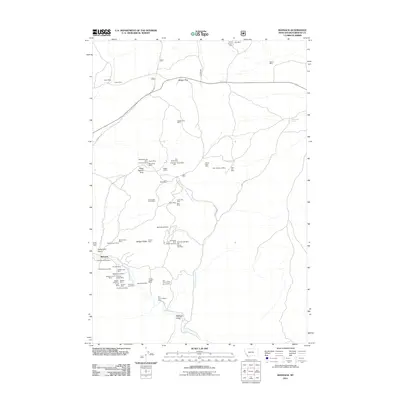
2011 Map of Bannack
USGS Topo · Published 2011About this map
Bannack anchors this portion of Beaverhead County, a landscape defined by an extraordinary concentration of mining claims and deep western history. The area along Grasshopper Creek and Hangmans Gulch shows the dense overlay of mineral extraction, from the Hope Placer Mine to hard-rock operations like the Senator/Arcata Mine and the Blue Wing Mine. The topography is marked by named features such as Road Agents Rock and Badger Ridge, while access is maintained by the historical Bannack Rd. The sheer density of named mines, including the New Departure Mine and Old Charter Oak Mine, illustrates a century of prospecting that transformed this terrain. Many of these sites, linked by secondary routes like Bon Accord Rd, represent the economic foundation of one of Montana's most famous early settlements.
Find a feature on this map
57 named features on this map. Tap any name to fly to it.
Don’t see what you’re looking for? This feature index may not catch every label — zoom into the map to look around manually.
Map Details
Editions of this 2011 Bannack Map
This is the sole edition of this map. No revisions or reprints were ever made.
Other maps of this area

1893 · Dillon
USGS Topo · 1:250,000

1952 · Argenta
USGS Topo · 1:24,000

1952 · Bannack
USGS Topo · 1:24,000

1952 · Burns Mountain
USGS Topo · 1:24,000

1952 · Eli Spring
USGS Topo · 1:24,000

1952 · Dalys
USGS Topo · 1:24,000

1952 · Ermont
USGS Topo · 1:24,000

1955 · Dillon
USGS Topo · 1:250,000

1957 · Dillon
USGS Topo · 1:250,000

1958 · Dillon
USGS Topo · 1:250,000