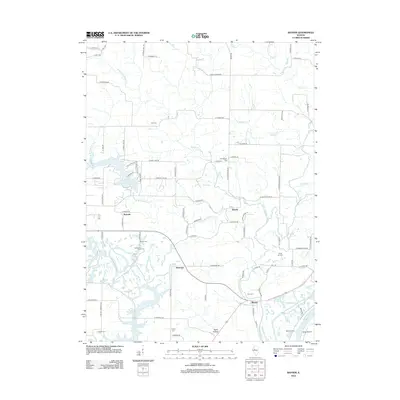
2012 Map of Banner
USGS Topo · Published 2012About this map
Canton City Lake and the winding course of Copperas Cr define this Central Illinois landscape, where the flat upland agricultural plains give way to the bottomlands of the Illinois River. This survey captures the rural character of Fulton County, dotted with historic burial grounds like Wolf Cem and Orendorff Cem that anchor the local lineage of the surrounding prairie. Smaller settlements and railroad-era junctions such as Rawalts, Breeds, and Monterey are spread across a network of country roads, while the southern edge is marked by industrial and natural water features including the Duck Creek Cooling Pond. The topography transitions sharply near Kings Hill and Baker Hollow, illustrating the drainage patterns of tributaries like Middle Br Copperas Cr and Tiber Cr as they move toward the river valley and King Island.
Find a feature on this map
86 named features on this map. Tap any name to fly to it.
Don’t see what you’re looking for? This feature index may not catch every label — zoom into the map to look around manually.
Map Details
Editions of this 2012 Banner Map
This is the sole edition of this map. No revisions or reprints were ever made.
Other maps of this area

1912 · Canton
USGS Topo · 1:62,500

1925 · Havana
USGS Topo · 1:62,500

1929 · Manito
USGS Topo · 1:62,500

1930 · Glasford
USGS Topo · 1:62,500

1932 · Manito
USGS Topo · 1:62,500

1947 · St. David
USGS Topo · 1:24,000

1948 · St. David
USGS Topo · 1:24,000

1948 · Glasford
USGS Topo · 1:62,500
1949 · Havana
USGS Topo · 1:62,500

1958 · Burlington
USGS Topo · 1:250,000