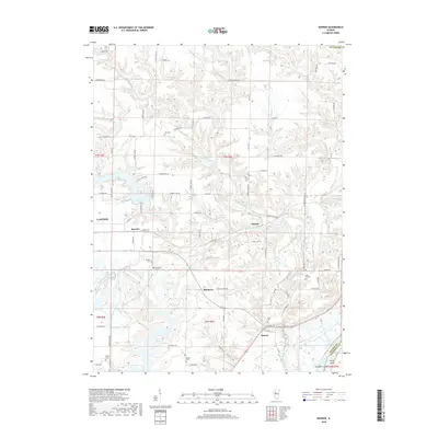
2018 Map of Banner
USGS Topo · Published 2018About this map
The unincorporated community of Banner sits near the southern edge of this Fulton County landscape, where the flatlands meet the wooded bluffs above the Illinois River valley. This 2018 survey reveals a terrain defined by the complex drainage of Copperas Creek and its many tributaries, including the Middle Branch Copperas Creek and West Branch Copperas Creek. These waterways carve deep ravines through the upland agricultural fields, creating a segmented pattern of settlement. Local history is anchored by numerous family and community burial grounds scattered across the townships, such as Wolf Cem, Orendorff Cem, and Red School Cem. Further west, the Duck Cr Cooling Pond and Canton Lake indicate the area's modern industrial and municipal water management, contrasting with the traditional small clusters at Breeds, Rawalts, and Monterey.
Find a feature on this map
55 named features on this map. Tap any name to fly to it.
Don’t see what you’re looking for? This feature index may not catch every label — zoom into the map to look around manually.
Map Details
Editions of this 2018 Banner Map
This is the sole edition of this map. No revisions or reprints were ever made.
Other maps of this area

1912 · Canton
USGS Topo · 1:62,500

1925 · Havana
USGS Topo · 1:62,500

1929 · Manito
USGS Topo · 1:62,500

1930 · Glasford
USGS Topo · 1:62,500

1932 · Manito
USGS Topo · 1:62,500

1947 · St. David
USGS Topo · 1:24,000

1948 · St. David
USGS Topo · 1:24,000

1948 · Glasford
USGS Topo · 1:62,500
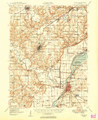
1949 · Havana
USGS Topo · 1:62,500

1958 · Burlington
USGS Topo · 1:250,000