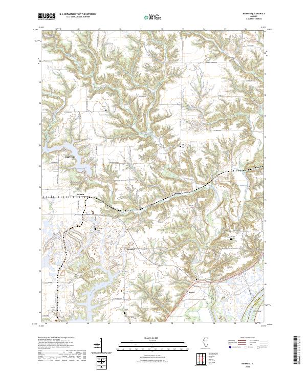
2024 Map of Banner
USGS Topo · Published 2024About this map
Illinois River bottomlands and the dissected uplands of eastern Fulton County define this landscape. The settlement of Banner sits near the base of the bluffs, where the valley floor meets the rugged drainage systems of Copperas Creek. To the north, the geography is marked by the winding courses of the Middle Branch Copperas Creek and West Branch Copperas Creek, which carve deep ravines into the plateau. The map reveals a dense network of rural family history, anchored by numerous burial grounds such as Wolfe Cem, Orendorff Cem, and the descriptively named Red Schoolhouse Cem. The eastern edge of Canton and its namesake Canton Lake appear in the northwest, while the southeastern corner is dominated by the river environment near King Island, illustrating the transition from agricultural ridge tops to the industrial and natural corridor of the Illinois valley.
Find a feature on this map
75 named features on this map. Tap any name to fly to it.
Don’t see what you’re looking for? This feature index may not catch every label — zoom into the map to look around manually.
Map Details
Editions of this 2024 Banner Map
This is the sole edition of this map. No revisions or reprints were ever made.
Other maps of this area

1912 · Canton
USGS Topo · 1:62,500

1925 · Havana
USGS Topo · 1:62,500

1929 · Manito
USGS Topo · 1:62,500

1930 · Glasford
USGS Topo · 1:62,500

1932 · Manito
USGS Topo · 1:62,500

1947 · St. David
USGS Topo · 1:24,000

1948 · St. David
USGS Topo · 1:24,000

1948 · Glasford
USGS Topo · 1:62,500
1949 · Havana
USGS Topo · 1:62,500

1958 · Burlington
USGS Topo · 1:250,000