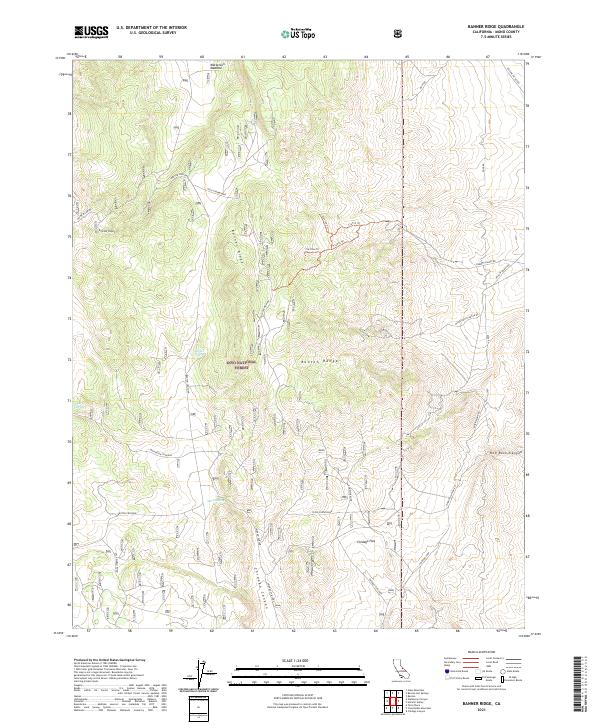
2021 Map of Banner Ridge
USGS Topo · Published 2021About this map
Banner Ridge and the Benton Range dominate this high-altitude landscape within the Inyo National Forest. The map documents a complex network of resource extraction and ranching infrastructure, evidenced by naming conventions like Gold Crown Mine and the Lonestar Mine. Water remains the critical anchor for activity in this arid terrain, with isolated points such as Banner Spring, Moran Spring, and Deer Spring providing essential lifeblood for the surrounding area.
Find a feature on this map
34 named features on this map. Tap any name to fly to it.
Don’t see what you’re looking for? This feature index may not catch every label — zoom into the map to look around manually.
Map Details
Editions of this 2021 Banner Ridge Map
This is the sole edition of this map. No revisions or reprints were ever made.
Other maps of this area

1914 · Mt. Morrison
USGS Topo · 1:125,000

1917 · White Mountain
USGS Topo · 1:125,000

1947 · Mariposa
USGS Topo · 1:250,000

1948 · Mariposa
USGS Topo · 1:250,000

1953 · Casa Diablo Mtn
USGS Topo · 1:62,500

1957 · Mariposa
USGS Topo · 1:250,000

1962 · Benton
USGS Topo · 1:62,500

1962 · Glass Mountain
USGS Topo · 1:62,500

1962 · White Mtn. Peak
USGS Topo · 1:62,500

1963 · Mariposa
USGS Topo · 1:250,000