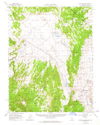
1962 Map of Glass Mountain
USGS Topo · Published 1964About this map
Benton Hot Springs anchors the southeastern edge of this high-altitude basin, where the Benton Valley meets the slopes of Blind Spring Hill. The 1962 landscape is defined by its transition from the volcanic peaks of Glass Mountain and Granite Mtn down into the broad expanse of the Adobe Valley. Water is the critical factor in this arid environment, evidenced by the scattered network of named springs and meadows like River Spring Lakes, Indian Meadows, and Keity Meadows that supported early ranching outposts including Adobe Ranch and Dutch Petes Ranch. Industrial activity is marked by various extractive sites, ranging from a Silicon Quarry and several Pumice Quarries to the Cowan Mine, while the former townsite of Pizona reflects the transient nature of mountain settlements in the Inyo National Forest.
Find a feature on this map
52 named features on this map. Tap any name to fly to it.
Don’t see what you’re looking for? This feature index may not catch every label — zoom into the map to look around manually.
Map Details
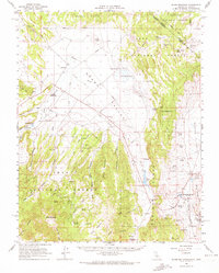
Editions of this 1962 Glass Mountain Map
2 editions found
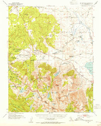
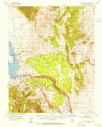
Other maps of this area

1909 · Hawthorne
USGS Topo · 1:250,000

1911 · Hawthorne
USGS Topo · 1:250,000

1914 · Mt. Morrison
USGS Topo · 1:125,000

1915 · Hawthorne
USGS Topo · 1:250,000

1917 · White Mountain
USGS Topo · 1:125,000

1947 · Mariposa
USGS Topo · 1:250,000

1948 · Walker Lake
USGS Topo · 1:250,000

1948 · Mariposa
USGS Topo · 1:250,000
1953 · Mt. Morrison
USGS Topo · 1:62,500
1953 · Casa Diablo Mtn
USGS Topo · 1:62,500