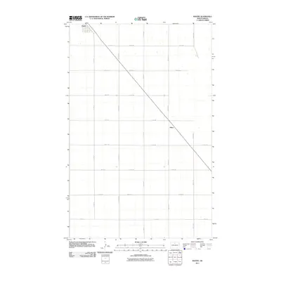
2011 Map of Bantry
USGS Topo · Published 2011About this map
Bantry occupies the northwestern corner of this McHenry County survey, situated at the junction of a local road network that radiates across the prairie. The landscape is defined by the rigid North Dakota section line grid, with arterial routes like 1st Ave N and Center Ave N providing the primary structure for the agricultural area. Moving southeast, the small settlement of Milroy appears along a diagonal transit line, a notable break from the otherwise square geometry of the township roads. This pattern of settlement reflects the typical Great Plains reliance on rail-aligned hubs for grain transport and commerce. The map records the numerous small ponds and depressions characteristic of the regional hydrology, scattered across the sections bounded by roads such as 74th St NE and 67th St NE.
Find a feature on this map
23 named features on this map. Tap any name to fly to it.
Don’t see what you’re looking for? This feature index may not catch every label — zoom into the map to look around manually.
Map Details
Editions of this 2011 Bantry Map
This is the sole edition of this map. No revisions or reprints were ever made.
Other maps of this area

1949 · Riga
USGS Topo · 1:24,000

1949 · Denbigh
USGS Topo · 1:24,000

1949 · Bantry
USGS Topo · 1:24,000

1950 · Towner NW
USGS Topo · 1:24,000

1950 · Upham SE
USGS Topo · 1:24,000

1950 · Towner
USGS Topo · 1:24,000

1950 · Upham
USGS Topo · 1:24,000

1950 · Willow City SW
USGS Topo · 1:24,000

1950 · Denbigh
USGS Topo · 1:24,000

1950 · Bantry NW
USGS Topo · 1:24,000