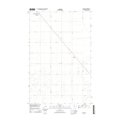
2014 Map of Bantry
USGS Topo · Published 2014About this map
Bantry and the smaller settlement of Milroy anchor this McHenry County landscape, oriented around the diagonal path of Nd-14. The town of Bantry maintains a defined residential grid, where local streets like Main St, Christianson St, and University St speak to the community's early planning and civic aspirations. Beyond the town limits, the terrain is characterized by the section-line geometry typical of the Great Plains, defined by an orderly network of rural roads such as 74th St NE and Center Ave N. The landscape's natural character is punctuated by numerous small depressions and intermittent water features, showing a prairie pothole topography that has shaped the drainage and agricultural patterns of the region. This 2014 survey serves as a clear record of the settlement footprint in North Dakota's northern reaches.
Find a feature on this map
30 named features on this map. Tap any name to fly to it.
Don’t see what you’re looking for? This feature index may not catch every label — zoom into the map to look around manually.
Map Details
Editions of this 2014 Bantry Map
This is the sole edition of this map. No revisions or reprints were ever made.
Other maps of this area

1949 · Riga
USGS Topo · 1:24,000

1949 · Denbigh
USGS Topo · 1:24,000

1949 · Bantry
USGS Topo · 1:24,000

1950 · Towner NW
USGS Topo · 1:24,000

1950 · Upham SE
USGS Topo · 1:24,000

1950 · Towner
USGS Topo · 1:24,000

1950 · Upham
USGS Topo · 1:24,000

1950 · Willow City SW
USGS Topo · 1:24,000

1950 · Denbigh
USGS Topo · 1:24,000

1950 · Bantry NW
USGS Topo · 1:24,000