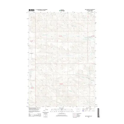
2014 Map of Bar V Ranch NE
USGS Topo · Published 2014About this map
The Wolf Mountains rise across this section of Big Horn County, defining a landscape of high ridges and deep drainage basins during the early twenty-first century. This territory is marked by the headwaters of several significant waterways, including the branching systems of the N Fork Rosebud Cr and the S Fork Rosebud Cr. The presence of Rosebud Battlefield Rd in the northeastern corner of the map provides a geographic link to the site of the 1876 Battle of the Rosebud, a pivotal conflict preceding the Battle of the Little Bighorn.
Find a feature on this map
29 named features on this map. Tap any name to fly to it.
Don’t see what you’re looking for? This feature index may not catch every label — zoom into the map to look around manually.
Map Details
Editions of this 2014 Bar V Ranch NE Map
This is the sole edition of this map. No revisions or reprints were ever made.
Other maps of this area

1894 · Rosebud
USGS Topo · 1:125,000

1901 · Rosebud
USGS Topo · 1:125,000

1954 · Hardin
USGS Topo · 1:250,000

1957 · Hardin
USGS Topo · 1:250,000

1958 · Hardin
USGS Topo · 1:250,000

1967 · Kid Creek
USGS Topo · 1:24,000

1967 · Wolf Mountain Lookout
USGS Topo · 1:24,000

1967 · Kirby
USGS Topo · 1:24,000

1967 · Bar V Ranch NE
USGS Topo · 1:24,000
1967 · Bar V Ranch
USGS Topo · 1:24,000