
1967 Map of Bar V Ranch NE
USGS Topo · Published 1971About this map
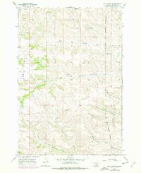
The Wolf Mountains dominate this 1967 terrain study of Big Horn County, Montana, providing a stark topographical backdrop to the headwaters of the Rosebud and Squirrel creek systems. A significant portion of the landscape is defined by the Crow Indian Reservation Boundary, which cuts across the drainage basins of North Fork Rosebud Creek and South Fork Rosebud Creek. This area of the High Plains is characterized by narrow creek bottoms and numerous upland water sources, including Commissary Springs and several unnamed Spring sites that likely served as critical watering points for local ranching operations. Human infrastructure is sparse in this era, though a solitary Landing Strip indicates the necessity of aerial access in this isolated cattle country. The map traces the intricate dendritic drainage patterns of North Fork Squirrel Creek and South Fork Squirrel Creek as they flow eastward from the mountain slopes.
Find a feature on this map
11 named features on this map. Tap any name to fly to it.
Don’t see what you’re looking for? This feature index may not catch every label — zoom into the map to look around manually.
Map Details
Editions of this 1967 Bar V Ranch NE Map
2 editions found
Other maps of this area

1894 · Rosebud
USGS Topo · 1:125,000

1901 · Rosebud
USGS Topo · 1:125,000

1954 · Hardin
USGS Topo · 1:250,000

1957 · Hardin
USGS Topo · 1:250,000

1958 · Hardin
USGS Topo · 1:250,000

1967 · Kid Creek
USGS Topo · 1:24,000

1967 · Wolf Mountain Lookout
USGS Topo · 1:24,000

1967 · Kirby
USGS Topo · 1:24,000
1967 · Bar V Ranch
USGS Topo · 1:24,000
1967 · Pearl School
USGS Topo · 1:24,000