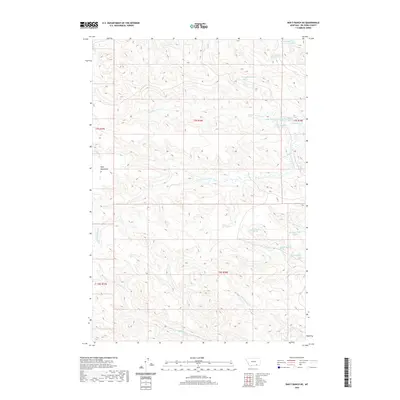
2020 Map of Bar V Ranch NE
USGS Topo · Published 2020About this map
Wolf Mountains dominate this high-plains landscape in Big Horn County, serving as a primary watershed for numerous named drainages. The area is defined by its complex network of seasonal and perennial water sources, including the N Fork Rosebud Cr and S Fork Rosebud Cr. These creek systems are fed by numerous small, specifically identified springs such as 07S38E14ACD01 Spring and several others located within the Township 7 South and Township 8 South boundaries. The survey reveals a terrain of high ridges and deep-cut drainage basins, including N Fork Spring Cr and N Fork Squirrel Cr. This section of Montana is characterized by its wide-open spaces and topographic variety, primarily used for large-scale ranching and land management as indicated by the section lines and township grids.
Find a feature on this map
24 named features on this map. Tap any name to fly to it.
Don’t see what you’re looking for? This feature index may not catch every label — zoom into the map to look around manually.
Map Details
Editions of this 2020 Bar V Ranch NE Map
This is the sole edition of this map. No revisions or reprints were ever made.
Other maps of this area

1894 · Rosebud
USGS Topo · 1:125,000

1901 · Rosebud
USGS Topo · 1:125,000

1954 · Hardin
USGS Topo · 1:250,000

1957 · Hardin
USGS Topo · 1:250,000

1958 · Hardin
USGS Topo · 1:250,000

1967 · Kid Creek
USGS Topo · 1:24,000

1967 · Wolf Mountain Lookout
USGS Topo · 1:24,000

1967 · Kirby
USGS Topo · 1:24,000

1967 · Bar V Ranch NE
USGS Topo · 1:24,000
1967 · Bar V Ranch
USGS Topo · 1:24,000