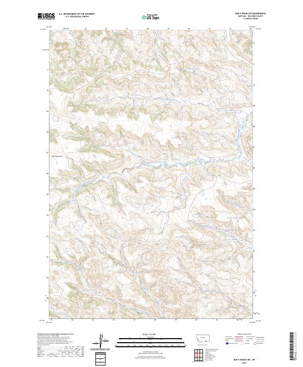
2024 Map of Bar V Ranch NE
USGS Topo · Published 2024About this map
The Wolf Mountains dominate this high-plains landscape in Big Horn County, characterized by a complex network of seasonal drainages and named water sources. This 2024 topographic survey captures the intricate hydrology of the region, where the North Fork Rosebud Creek and South Fork Rosebud Creek carve through the terrain. The map is particularly notable for its documentation of specific water points, including 07S38E14ACDD01 Spring and 08S38E02CCBA01 Spring, which reflect the essential nature of reliable water in this part of Montana.
Find a feature on this map
19 named features on this map. Tap any name to fly to it.
Don’t see what you’re looking for? This feature index may not catch every label — zoom into the map to look around manually.
Map Details
Editions of this 2024 Bar V Ranch NE Map
This is the sole edition of this map. No revisions or reprints were ever made.
Other maps of this area

1894 · Rosebud
USGS Topo · 1:125,000

1901 · Rosebud
USGS Topo · 1:125,000

1954 · Hardin
USGS Topo · 1:250,000

1957 · Hardin
USGS Topo · 1:250,000

1958 · Hardin
USGS Topo · 1:250,000

1967 · Kid Creek
USGS Topo · 1:24,000

1967 · Wolf Mountain Lookout
USGS Topo · 1:24,000

1967 · Kirby
USGS Topo · 1:24,000

1967 · Bar V Ranch NE
USGS Topo · 1:24,000
1967 · Bar V Ranch
USGS Topo · 1:24,000