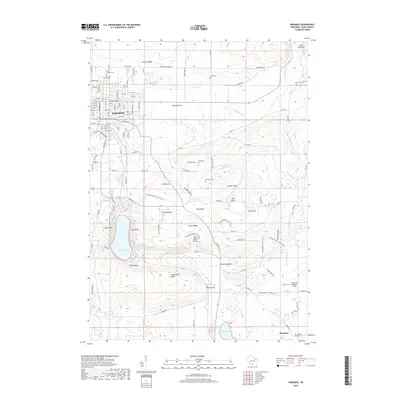
2018 Map of Baraboo
USGS Topo · Published 2018About this map
Baraboo sits at the center of a dramatic landscape defined by the North Range and South Range of the Baraboo Hills. The topographical character of the region is punctuated by deep basins and prominent overlooks like East Bluff and West Bluff, which frame the waters of Devils Lake. South of the city, the complex terrain includes the deep ravine of Parfreys Glen and the natural depression of Steinke Basin. In the north, the Baraboo River meanders toward the Lower Narrows, passing Pecks Prairie. Local genealogy is well-documented through numerous burial sites, including Walnut Hill Cem and Saint Josephs Cem in town, and more isolated locations like Brewster Cem and Zuch Cem situated among the upland farms. Near the southern edge, the small settlement of Merrimac appears near Gallus Slough and the Prairie Hill McDaniel Field.
Find a feature on this map
126 named features on this map. Tap any name to fly to it.
Don’t see what you’re looking for? This feature index may not catch every label — zoom into the map to look around manually.
Map Details
Editions of this 2018 Baraboo Map
This is the sole edition of this map. No revisions or reprints were ever made.
Other maps of this area

1895 · Baraboo
USGS Topo · 1:62,500

1901 · Denzer
USGS Topo · 1:62,500

1901 · The Dells
USGS Topo · 1:62,500

1902 · Briggsville
USGS Topo · 1:62,500

1908 · Baraboo
USGS Topo · 1:62,500

1957 · Wisconsin Dells
USGS Topo · 1:62,500

1957 · Madison
USGS Topo · 1:250,000

1958 · Briggsville
USGS Topo · 1:62,500

1958 · North Freedom
USGS Topo · 1:62,500

1959 · Baraboo
USGS Topo · 1:62,500