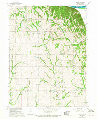
1966 Map of Barada
USGS Topo · Published 1968About this map
Barada and Arago anchor this mid-1960s survey of the eastern edge of Richardson County, where the topography breaks sharply toward the Missouri River. The landscape is defined by a dense network of rural infrastructure, including numerous family-named landmarks and local institutions like St Anns Cath Ch and the Fricke Cem. The transition from the high bluffs near Indian Cave to the winding courses of Muddy Creek and Silver Creek reveals a deeply dissected terrain that influenced the placement of the region’s many schoolhouses. Educational history is particularly well-represented here, with several distinct districts visible through locations like Williamsville Sch, Glendale Sch, and Arago Center Sch. The presence of an Oil Well and a Radio Tower among the traditional farmsteads and cemeteries indicates the modest modernization of the rural economy during this period.
Find a feature on this map
37 named features on this map. Tap any name to fly to it.
Don’t see what you’re looking for? This feature index may not catch every label — zoom into the map to look around manually.
Map Details
Editions of this 1966 Barada Map
2 editions found
Other maps of this area

1915 · Falls City
USGS Topo · 1:62,500

1915 · Nemaha
USGS Topo · 1:62,500

1920 · Craig
USGS Topo · 1:62,500

1936 · Fairfax
USGS Topo · 1:24,000

1939 · Tarkio
USGS Topo · 1:62,500

1939 · Nemaha
USGS Topo · 1:62,500

1940 · Tarkio
USGS Topo · 1:62,500

1941 · Tarkio
USGS Topo · 1:62,500

1949 · Nemaha
USGS Topo · 1:62,500

1955 · Nebraska City
USGS Topo · 1:250,000