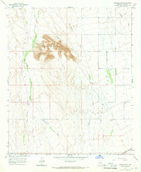
1965 Map of Baragan Mtn
USGS Topo · Published 1966About this map
Baragan Mountain rises as a prominent landmark above the desert floor in this mid-1960s survey of southwestern Arizona. The landscape is defined by the expansive Hyder Valley, where a network of ephemeral drainages including Red Raven Wash, Clanton Wash, and Deadman Wash carve through the arid terrain. The mapping reveals a sparse but vital infrastructure of water sources such as Hyder Well and several unnamed wells scattered across the valley. Transportation in this era was anchored by the Southern Pacific railroad cutting across the southern edge of the sheet, while the Harquahala Palomas Road provided a north-south thoroughfare through the desert. The presence of numerous fence lines indicates the integration of this rugged territory into regional ranching operations, even as the natural topography of Baragan Wash and Nottbusch Wash remained the dominant geographic features.
Find a feature on this map
12 named features on this map. Tap any name to fly to it.
Don’t see what you’re looking for? This feature index may not catch every label — zoom into the map to look around manually.
Map Details
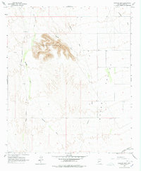
Editions of this 1965 Baragan Mtn Map
2 editions found
Other maps of this area

1927 · Hyder
USGS Topo · 1:62,500

1929 · Aztec
USGS Topo · 1:62,500

1930 · Stoval
USGS Topo · 1:62,500

1930 · Hyder
USGS Topo · 1:62,500

1942 · Vicksburg
USGS Topo · 1:250,000

1950 · Stoval
USGS Topo · 1:62,500

1950 · Aztec
USGS Topo · 1:62,500

1953 · Ajo
USGS Topo · 1:250,000

1954 · Phoenix
USGS Topo · 1:250,000

1957 · Ajo
USGS Topo · 1:250,000