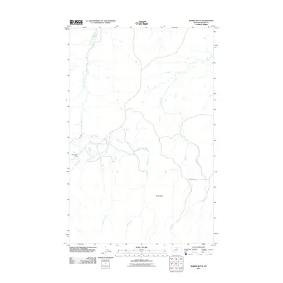
2011 Map of Barber Butte
USGS Topo · Published 2011About this map
Barber Butte rises above a high plains landscape in Blaine County, defined by the winding drainages of the northern Montana prairie. This 2011 survey captures the hydrological network where Wind Creek and Grindstone Creek converge before joining the larger path of Clear Creek. The transportation footprint is sparse, centered on the Clear Creek Rd corridor and the essential Clear Creek Bridge crossing. The map reveals a ranching landscape where seasonal waterways like Bean Creek carve through the terrain, reflecting the modern management of these traditional grazing lands. It provides a clear view of the topographic isolation and the vital role of bridge infrastructure in this remote part of the state.
Find a feature on this map
7 named features on this map. Tap any name to fly to it.
Don’t see what you’re looking for? This feature index may not catch every label — zoom into the map to look around manually.
Map Details
Editions of this 2011 Barber Butte Map
This is the sole edition of this map. No revisions or reprints were ever made.
Other maps of this area

1953 · Havre
USGS Topo · 1:250,000

1956 · Maddux
USGS Topo · 1:62,500

1956 · Lloyd
USGS Topo · 1:62,500

1957 · Havre
USGS Topo · 1:250,000

1958 · Havre
USGS Topo · 1:250,000

1959 · Warrick
USGS Topo · 1:62,500

1959 · Shambo
USGS Topo · 1:62,500
1984 · Shambo NE
USGS Topo · 1:24,000

1984 · Big John Butte
USGS Topo · 1:24,000
1984 · Shambo SE
USGS Topo · 1:24,000