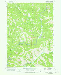
1972 Map of Barber Flat
USGS Topo · Published 1976About this map
North Fork Boise River and its confluence with various mountain tributaries define this segment of the Boise National Forest during the early 1970s. The landscape is characterized by a network of historic access routes, including the Hungarian Pack Trail and numerous unnamed jeep trails that navigate the steep terrain of the Boise Ridge. In the river valleys, the map identifies specific recreational and administrative sites such as the Barber Flat Forest Service Station and the Black Rock Campground. A notable geothermal feature, Springs (Hot), is located near the Middle Fork Boise River, suggesting the long-standing use of this area for both resource management and backcountry exploration. Small-scale industrial history is hinted at by a Prospect located along the creek drainage west of Barber Flat.
Find a feature on this map
43 named features on this map. Tap any name to fly to it.
Don’t see what you’re looking for? This feature index may not catch every label — zoom into the map to look around manually.
Map Details
Editions of this 1972 Barber Flat Map
This is the sole edition of this map. No revisions or reprints were ever made.
Other maps of this area

1894 · Idaho Basin
USGS Topo · 1:125,000

1894 · Rocky Bar
USGS Topo · 1:125,000

1955 · Hailey
USGS Topo · 1:250,000

1959 · Hailey
USGS Topo · 1:250,000

1962 · Hailey
USGS Topo · 1:250,000

1964 · Little Trinity Lake
USGS Topo · 1:24,000

1964 · Sheep Creek
USGS Topo · 1:24,000

1964 · Twin Springs
USGS Topo · 1:24,000
1972 · Rabbit Creek Summit
USGS Topo · 1:24,000
1972 · Big Owl Creek
USGS Topo · 1:24,000