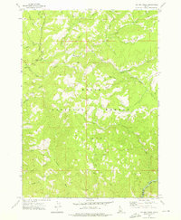
1972 Map of Big Owl Creek
USGS Topo · Published 1976About this map
The Boise National Forest provides the backdrop for this 1970s survey, illustrating a landscape defined by its network of mountain waterways and early land management infrastructure. Evidence of industrial activity remains visible through the Dredge Tailings located along Beaver Creek, a telltale sign of past mineral extraction in the Idaho backcountry. The Beaver Creek Forest Service Station serves as a central landmark for this area, which straddles the boundary between Boise and Elmore counties. The map traces the winding paths of the Crooked River and the Boise River Fork, alongside recreational sites like the Willow Creek Campground and Edna Creek Campground. Numerous drainage systems, including Big Owl Creek and Pikes Fork, are accessible only by the primitive Jeep Trails that crisscross the high elevations.
Find a feature on this map
29 named features on this map. Tap any name to fly to it.
Don’t see what you’re looking for? This feature index may not catch every label — zoom into the map to look around manually.
Map Details
Editions of this 1972 Big Owl Creek Map
This is the sole edition of this map. No revisions or reprints were ever made.
Other maps of this area

1891 · Bear Valley
USGS Topo · 1:125,000

1893 · Bear Valley
USGS Topo · 1:125,000

1894 · Idaho Basin
USGS Topo · 1:125,000

1894 · Rocky Bar
USGS Topo · 1:125,000

1909 · Garden Valley
USGS Topo · 1:125,000

1955 · Hailey
USGS Topo · 1:250,000

1957 · Challis
USGS Topo · 1:250,000

1959 · Hailey
USGS Topo · 1:250,000

1960 · Challis
USGS Topo · 1:250,000

1962 · Hailey
USGS Topo · 1:250,000