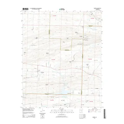
2014 Map of Barber
USGS Topo · Published 2014About this map
Devils Backbone Ridge and the Washburn Mountains dominate this 2014 survey of the borderlands between Sebastian, Logan, and Franklin Counties. This portion of the Ouachita region is characterized by narrow gaps and ridges, notably at Backbone Narrows and Bradshaw Narrows, where the terrain forced early settlement patterns. Rural communities like Washburn and Barber are documented with significant genealogical detail, including several family and community burial grounds such as Rebecca Lewis Cem, Spencer Cem, and Pleasant Ridge Cem. The landscape reflects a mix of natural water features like Washburn Creek and Pigeon Cr alongside industrial development in the Booneville Gas Field and the creation of Booneville Lake.
Find a feature on this map
94 named features on this map. Tap any name to fly to it.
Don’t see what you’re looking for? This feature index may not catch every label — zoom into the map to look around manually.
Map Details
Editions of this 2014 Barber Map
This is the sole edition of this map. No revisions or reprints were ever made.
Other maps of this area

1887 · Magazine Mountain #2
USGS Topo · 1:62,500

1887 · Magazine Mountain #3
USGS Topo · 1:62,500

1887 · Magazine Mountain
USGS Topo · 1:62,500

1890 · Magazine Mountain
USGS Topo · 1:125,000

1890 · Fort Smith
USGS Topo · 1:125,000

1906 · Lavaca
USGS Topo · 1:62,500

1906 · Barber
USGS Topo · 1:62,500

1934 · Booneville
USGS Topo · 1:48,000

1939 · Booneville
USGS Topo · 1:62,500

1943 · Fort Smith
USGS Topo · 1:125,000