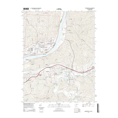
2014 Map of Barboursville
USGS Topo · Published 2014About this map
The Ohio River carves a deep valley through the center of this landscape, separating the residential development of Proctorville and Quaker Bottom in Ohio from the growing suburbs of West Virginia. The terrain is defined by high ridges like Carson Ridge and Big Seven Mile Ridge, where numerous small creeks like Sevenmile Cr and Ninernile Cr have cut deep ravines into the plateau. The southern portion of the map is dominated by the dense residential expansion of Pea Ridge and Barboursville, situated between the Guyandotte River and the Mud River. Transportation networks are prominent, featuring the CSX Transportation line and several notable river crossings, including the General McComas Bridge and the Guyandotte River Overpass. Local history is preserved in sites such as Beulah Baptist Cem and Mt Pisgah Cem.
Find a feature on this map
91 named features on this map. Tap any name to fly to it.
Don’t see what you’re looking for? This feature index may not catch every label — zoom into the map to look around manually.
Map Details
Editions of this 2014 Barboursville Map
This is the sole edition of this map. No revisions or reprints were ever made.
Other maps of this area

1892 · Huntington
USGS Topo · 1:125,000

1898 · Huntington
USGS Topo · 1:125,000

1901 · Guyandot
USGS Topo · 1:62,500

1902 · Guyandot
USGS Topo · 1:62,500

1902 · Milton
USGS Topo · 1:62,500

1906 · Athalia
USGS Topo · 1:62,500

1906 · Glenwood
USGS Topo · 1:62,500

1908 · Athalia
USGS Topo · 1:62,500

1908 · Glenwood
USGS Topo · 1:62,500

1931 · Milton
USGS Topo · 1:62,500