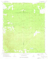
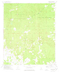
1973 Map of Barge Lake
USGS Topo · Published 1975About this map
The Noxubee National Wildlife Refuge dominates the landscape across the Winston and Noxubee county line, preserving a complex network of wetlands and creeks as they appeared in the early 1970s. The terrain is defined by the meandering courses of Lynn Creek, Horse Creek, and Yellow Creek, with the large expanse of Loakfoma Lake in the north and the smaller Barge Lake to the south. This area serves as a significant intersection of conservation land and local rural heritage, where family and community landmarks remain embedded within the refuge boundaries.
Find a feature on this map
23 named features on this map. Tap any name to fly to it.
Don’t see what you’re looking for? This feature index may not catch every label — zoom into the map to look around manually.
Map Details
Editions of this 1973 Barge Lake Map
2 editions found
Other maps of this area

1953 · West Point
USGS Topo · 1:250,000

1958 · West Point
USGS Topo · 1:250,000

1959 · Artesia
USGS Topo · 1:62,500

1963 · West Point
USGS Topo · 1:250,000

1965 · Bluff Lake
USGS Topo · 1:24,000

1965 · Bradley
USGS Topo · 1:24,000
1973 · Boon
USGS Topo · 1:24,000
1973 · Fearns Springs
USGS Topo · 1:24,000
1973 · Barge Lake
USGS Topo · 1:24,000
1973 · Betheden
USGS Topo · 1:24,000