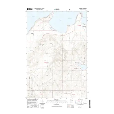
2015 Map of Bark Bay
USGS Topo · Published 2015About this map
The south shore of Lake Superior dominates this landscape, where the settlements of Herbster and Cornucopia serve as gateways to the bay-indented coastline of Bayfield County. The map details the intricate relationship between the land and water, featuring prominent landforms such as Bark Point and Roman Point which shelter Bark Bay and Siskiwit Bay. Inland, the terrain rises into the northern reaches of the Chequamegon National Forest, a heavily wooded area drained by numerous waterways including Bark River and the three branches of Lost Creek.
Find a feature on this map
57 named features on this map. Tap any name to fly to it.
Don’t see what you’re looking for? This feature index may not catch every label — zoom into the map to look around manually.
Map Details
Editions of this 2015 Bark Bay Map
This is the sole edition of this map. No revisions or reprints were ever made.
Other maps of this area

1943 · Port Wing
USGS Topo · 1:48,000

1943 · Iron Lake
USGS Topo · 1:48,000

1944 · Moquah
USGS Topo · 1:48,000

1944 · Cornucopia
USGS Topo · 1:48,000

1946 · Cornucopia
USGS Topo · 1:48,000

1946 · Port Wing
USGS Topo · 1:48,000

1947 · Moquah
USGS Topo · 1:48,000

1947 · Iron Lake
USGS Topo · 1:48,000

1953 · Ashland
USGS Topo · 1:250,000

1958 · Ashland
USGS Topo · 1:250,000