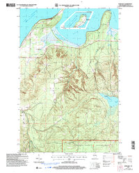
2005 Map of Bark Bay
USGS Topo · Published 2006About this map
Bark Point and Roman Point define the rugged shoreline of Lake Superior in this northern Wisconsin coastal survey. The map details the transition from the open waters of Bark Bay and Siskiwit Bay to the interior wetlands and forests of the Clover and Bell townships. Local landmarks such as the Herbster Cem and several Gravel Pit locations provide points of interest for genealogists and local historians tracking early 21st-century land use.
Find a feature on this map
16 named features on this map. Tap any name to fly to it.
Don’t see what you’re looking for? This feature index may not catch every label — zoom into the map to look around manually.
Map Details
Editions of this 2005 Bark Bay Map
This is the sole edition of this map. No revisions or reprints were ever made.
Other maps of this area

1943 · Port Wing
USGS Topo · 1:48,000

1943 · Iron Lake
USGS Topo · 1:48,000

1944 · Moquah
USGS Topo · 1:48,000

1944 · Cornucopia
USGS Topo · 1:48,000

1946 · Cornucopia
USGS Topo · 1:48,000

1946 · Port Wing
USGS Topo · 1:48,000

1947 · Moquah
USGS Topo · 1:48,000

1947 · Iron Lake
USGS Topo · 1:48,000

1953 · Ashland
USGS Topo · 1:250,000

1958 · Ashland
USGS Topo · 1:250,000