
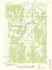
1932 Map of Bark River NE
USGS Topo · Published 1932About this map
The boundary between Menominee Co and Delta Co cuts vertically through this landscape of the Upper Peninsula, where the Bark River and its tributaries define the drainage of the region. The settlement of Bark River and the nearby community of Harris serve as the primary hubs along the east-west corridor formed by the Chicago and Northwestern railroad and the parallel Chicago and Northwestern Highway Nos 2 & 41. This transportation spine supported the early 20th-century economy of the Harris, Bark River, and Gourley townships. Rural life is anchored by local landmarks such as Sunnyside Sch and Riverside Sch, while a string of northern water bodies including First Lake, Second Lake, and Mud Lake dot the wetlands. The map provides a look at the rural infrastructure before significant mid-century modernizations, preserving the positions of small schools and local drainages like Trout Creek and Depas Creek.
Find a feature on this map
16 named features on this map. Tap any name to fly to it.
Don’t see what you’re looking for? This feature index may not catch every label — zoom into the map to look around manually.
Map Details
Editions of this 1932 Bark River NE Map
2 editions found
Other maps of this area

1932 · Whitney SE
USGS Topo · 1:31,680

1932 · Gladstone SW
USGS Topo · 1:31,680

1954 · Escanaba
USGS Topo · 1:250,000

1957 · Escanaba
USGS Topo · 1:250,000

1958 · Escanaba
USGS Topo · 1:250,000

1958 · Gladstone
USGS Topo · 1:62,500

1958 · Escanaba
USGS Topo · 1:62,500

1963 · Bark River
USGS Topo · 1:62,500

1963 · Schaffer
USGS Topo · 1:62,500

1982 · Escanaba
USGS Topo · 1:100,000