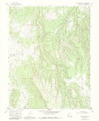
1964 Map of Barkelew Draw
USGS Topo · Published 1984About this map
Hamilton Mesa and the elevated plateaus of Lilylands dominate this landscape on the western edge of the Uncompahgre National Forest. The map illustrates a complex network of seasonal drainage systems, including Hamilton Creek, Barkelew Draw, and Nelson Creek, which carve through the high desert terrain. Human activity is marked by the presence of the Basin Sch and the extensive Lilylands Canal, reflecting the importance of water management in this arid ranching and forest region. The irregular terrain of East Broad Canyon and various gravel pits suggests a landscape shaped by both natural erosion and localized resource extraction. The distribution of features like the Two Fork Reservoir underscores the reliance on surface water storage for local use in the mid-20th century.
Find a feature on this map
17 named features on this map. Tap any name to fly to it.
Don’t see what you’re looking for? This feature index may not catch every label — zoom into the map to look around manually.
Map Details
Editions of this 1964 Barkelew Draw Map
3 editions found
Other maps of this area

1916 · Paradox Valley
USGS Topo · 1:125,000

1922 · Paradox Valley
USGS Topo · 1:125,000

1956 · Cortez
USGS Topo · 1:250,000

1956 · Moab
USGS Topo · 1:250,000

1958 · Cortez
USGS Topo · 1:250,000

1959 · Cortez
USGS Topo · 1:250,000

1959 · Moab
USGS Topo · 1:250,000

1960 · Moab
USGS Topo · 1:250,000

1962 · Moab
USGS Topo · 1:250,000

1962 · Cortez
USGS Topo · 1:250,000