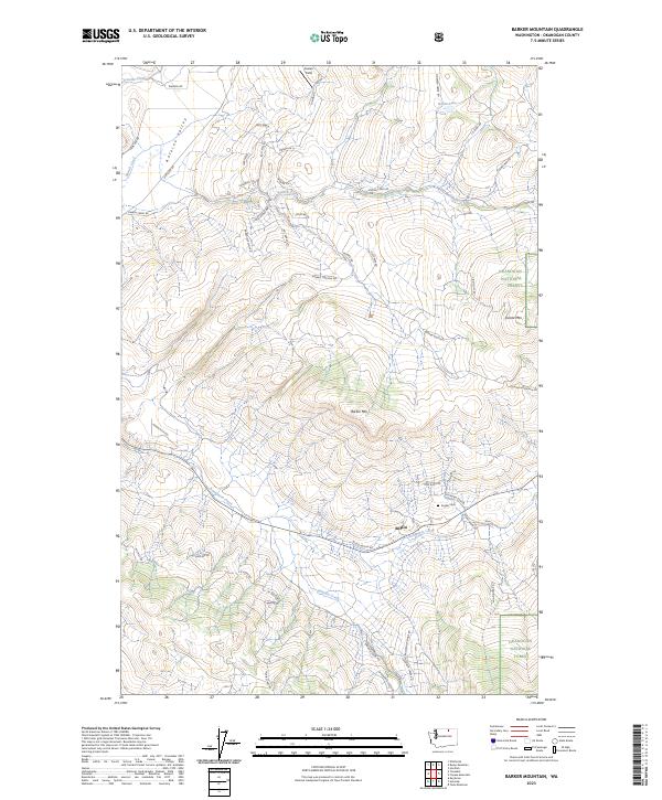
2023 Map of Barker Mountain
USGS Topo · Published 2023About this map
Anglin occupies a central role in this northern Washington landscape, situated along the banks of Bonaparte Creek as it winds through the southern reaches of the quadrangle. The settlement is anchored by the Anglin Cem, providing a focal point for genealogical research in this part of Okanogan County. The terrain is defined by significant elevations including Barker Mtn and Island Mtn, while the Antoine Valley carves a path through the northwest corner, drained by Antoine Creek.
Find a feature on this map
57 named features on this map. Tap any name to fly to it.
Don’t see what you’re looking for? This feature index may not catch every label — zoom into the map to look around manually.
Map Details
Editions of this 2023 Barker Mountain Map
This is the sole edition of this map. No revisions or reprints were ever made.
Other maps of this area

1902 · Osoyoos
USGS Topo · 1:125,000

1904 · Osoyoos
USGS Topo · 1:125,000

1954 · Okanogan
USGS Topo · 1:250,000

1957 · Mt. Bonaparte
USGS Topo · 1:62,500

1957 · Tonasket
USGS Topo · 1:62,500

1957 · Oroville
USGS Topo · 1:62,500

1957 · Aeneas Valley
USGS Topo · 1:62,500

1958 · Okanogan
USGS Topo · 1:250,000
1980 · Keystone
USGS Topo · 1:24,000
1981 · Tonasket
USGS Topo · 1:24,000