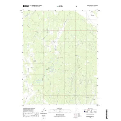
2020 Map of Barker Reservoir
USGS Topo · Published 2020About this map
The Escalante Mountains dominate this high-elevation landscape within the Dixie National Forest, where a sophisticated network of small-scale water management features is evident. Numerous reservoirs, including Barker Reservoir, Lower Barker Reservoir, and Joe Lay Reservoir, are concentrated around Dougherty Basin, illustrating the importance of water storage in this arid Utah environment. The mapping reveals a transition from the high ridges of Griffin Top down toward Whites Flat and Whites Cove, showing how the terrain dictates the flow of Antimony Creek and the W Fork N Creek.
Find a feature on this map
51 named features on this map. Tap any name to fly to it.
Don’t see what you’re looking for? This feature index may not catch every label — zoom into the map to look around manually.
Map Details
Editions of this 2020 Barker Reservoir Map
This is the sole edition of this map. No revisions or reprints were ever made.
Other maps of this area

1885 · Fish Lake
USGS Topo · 1:250,000

1886 · Escalante
USGS Topo · 1:250,000

1896 · Fish Lake
USGS Topo · 1:250,000

1956 · Escalante
USGS Topo · 1:250,000

1956 · Salina
USGS Topo · 1:250,000

1960 · Escalante
USGS Topo · 1:250,000

1960 · Salina
USGS Topo · 1:250,000

1962 · Salina
USGS Topo · 1:250,000

1964 · Griffin Point
USGS Topo · 1:24,000

1964 · Barker Reservoir
USGS Topo · 1:24,000