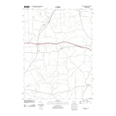
2010 Map of Barkeyville
USGS Topo · Published 2010About this map
Barkeyville serves as a central point in this rural landscape, situated where local roads converge in southern Venango County. The area is characterized by several small, established settlements such as Wesley, Nectarine, and Bullion, reflecting the traditional township development of western Pennsylvania. Genealogical interest is anchored by Mount Irwin Cemetery and Pleasantview Cemetery, while the presence of Gillmans Mill on a tributary of Scrubgrass Creek suggests a history of small-scale water-powered industry. The terrain is defined by a dense network of waterways, including North Branch Slippery Rock Creek and Blacks Creek, which carve through the countryside. Much of the northern territory is occupied by the protected acreage of Game Land 39, preserving the natural character of the hills between the scattered hamlets and family-named routes like Barkey Hoffman Rd.
Find a feature on this map
77 named features on this map. Tap any name to fly to it.
Don’t see what you’re looking for? This feature index may not catch every label — zoom into the map to look around manually.
Map Details
Editions of this 2010 Barkeyville Map
This is the sole edition of this map. No revisions or reprints were ever made.
Other maps of this area

1909 · Franklin
USGS Topo · 1:62,500

1910 · Hilliards
USGS Topo · 1:62,500

1911 · Franklin
USGS Topo · 1:62,500

1911 · Stoneboro
USGS Topo · 1:62,500

1912 · Hilliards
USGS Topo · 1:62,500

1913 · Stoneboro
USGS Topo · 1:62,500

1913 · Mercer
USGS Topo · 1:62,500

1939 · Mercer
USGS Topo · 1:62,500

1943 · Mercer
USGS Topo · 1:62,500

1943 · Stoneboro
USGS Topo · 1:62,500