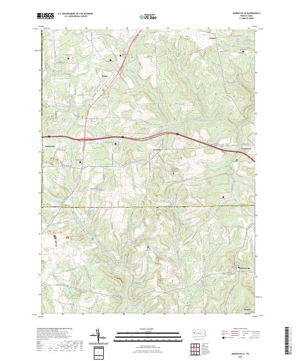
2023 Map of Barkeyville
USGS Topo · Published 2023About this map
The headwaters of Scrubgrass Creek and Blacks Creek define this rural landscape on the Venango County and Butler County line. The area is characterized by a dense network of family-named cemeteries and small community clusters, reflecting a deep-rooted agricultural and settlement history. Barkeyville and Clintonville serve as central nodes, connected by the historical corridor of Pittsburgh Rd and the more modern path of Gibb Rd.
Find a feature on this map
97 named features on this map. Tap any name to fly to it.
Don’t see what you’re looking for? This feature index may not catch every label — zoom into the map to look around manually.
Map Details
Editions of this 2023 Barkeyville Map
This is the sole edition of this map. No revisions or reprints were ever made.
Other maps of this area

1909 · Franklin
USGS Topo · 1:62,500

1910 · Hilliards
USGS Topo · 1:62,500

1911 · Franklin
USGS Topo · 1:62,500

1911 · Stoneboro
USGS Topo · 1:62,500

1912 · Hilliards
USGS Topo · 1:62,500

1913 · Stoneboro
USGS Topo · 1:62,500

1913 · Mercer
USGS Topo · 1:62,500

1939 · Mercer
USGS Topo · 1:62,500

1943 · Mercer
USGS Topo · 1:62,500

1943 · Stoneboro
USGS Topo · 1:62,500