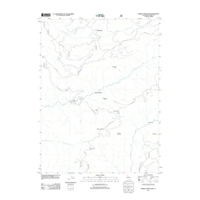
2012 Map of Barkley Mountain
USGS Topo · Published 2012About this map
Barkley Mountain and the deep drainage of Mill Cr define this portion of Tehama County, where the landscape is marked by remote outposts and historic passage routes. Named locations such as Savercool Place and Yellowjacket suggest a history of seasonal habitation and resource management within the forest. The map documents significant local landmarks like The Narrows and Mill Creek Rim, alongside several named flats and points that serve as essential waypoints in this steep terrain.
Find a feature on this map
30 named features on this map. Tap any name to fly to it.
Don’t see what you’re looking for? This feature index may not catch every label — zoom into the map to look around manually.
Map Details
Editions of this 2012 Barkley Mountain Map
This is the sole edition of this map. No revisions or reprints were ever made.
Other maps of this area

1886 · Lassen Peak
USGS Topo · 1:250,000

1892 · Lassen Peak
USGS Topo · 1:250,000

1894 · Lassen Peak
USGS Topo · 1:250,000

1935 · Paynes Creek
USGS Topo · 1:96,000

1941 · Mineral
USGS Topo · 1:125,000
1953 · Panther Spring
USGS Topo · 1:62,500

1955 · Westwood
USGS Topo · 1:250,000

1956 · Lassen Peak
USGS Topo · 1:62,500

1956 · Manton
USGS Topo · 1:62,500

1958 · Westwood
USGS Topo · 1:250,000