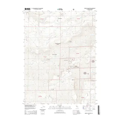
2015 Map of Barkley Mountain
USGS Topo · Published 2015About this map
Lassen National Forest terrain dominates this northern California survey, where the deep drainages of Mill Creek and Deer Creek carve through the volcanic landscape of Tehama County. The map documents a sparsely populated region defined by isolated points like Yellowjacket and Savercool Place, connected by historic routes including the Lassen Trl and Ponderosa Way. Geological and topographic landmarks are plentiful, ranging from the prominent Barkley Mtn and Flatiron Mtn to the narrow gorge identified as The Narrows. Significant water sources, such as Obe Fields Spring and Sheep Camp Spring, suggest the critical importance of water management in these upland forests. The presence of named flats and coves, including Four Lantern Flat and Wilson Cove, provides insight into the local nomenclature used by foresters and early settlers to navigate the complex ridges and canyons.
Find a feature on this map
39 named features on this map. Tap any name to fly to it.
Don’t see what you’re looking for? This feature index may not catch every label — zoom into the map to look around manually.
Map Details
Editions of this 2015 Barkley Mountain Map
This is the sole edition of this map. No revisions or reprints were ever made.
Other maps of this area

1886 · Lassen Peak
USGS Topo · 1:250,000

1892 · Lassen Peak
USGS Topo · 1:250,000

1894 · Lassen Peak
USGS Topo · 1:250,000

1935 · Paynes Creek
USGS Topo · 1:96,000

1941 · Mineral
USGS Topo · 1:125,000
1953 · Panther Spring
USGS Topo · 1:62,500

1955 · Westwood
USGS Topo · 1:250,000

1956 · Lassen Peak
USGS Topo · 1:62,500

1956 · Manton
USGS Topo · 1:62,500

1958 · Westwood
USGS Topo · 1:250,000