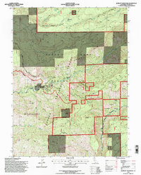
1995 Map of Barkley Mountain
USGS Topo · Published 1998About this map
Lassen National Forest terrain dominates this 1990s survey, defined by the deep drainage systems of Mill Creek and Antelope Creek. The landscape transitions from high ridges like Mill Creek Rim to significant peaks such as Barkley Mountain and Flatiron Mountain. Pockets of human history are preserved in the form of named camps and old residential sites, including the Yellowjacket (Site) and Savercool Place. These locations, along with the Sheeppert Camp, suggest a legacy of seasonal resource use in the canyon country.
Find a feature on this map
37 named features on this map. Tap any name to fly to it.
Don’t see what you’re looking for? This feature index may not catch every label — zoom into the map to look around manually.
Map Details
Editions of this 1995 Barkley Mountain Map
This is the sole edition of this map. No revisions or reprints were ever made.
Other maps of this area

1886 · Lassen Peak
USGS Topo · 1:250,000

1892 · Lassen Peak
USGS Topo · 1:250,000

1894 · Lassen Peak
USGS Topo · 1:250,000

1935 · Paynes Creek
USGS Topo · 1:96,000

1941 · Mineral
USGS Topo · 1:125,000
1953 · Panther Spring
USGS Topo · 1:62,500

1955 · Westwood
USGS Topo · 1:250,000

1956 · Lassen Peak
USGS Topo · 1:62,500

1956 · Manton
USGS Topo · 1:62,500

1958 · Westwood
USGS Topo · 1:250,000