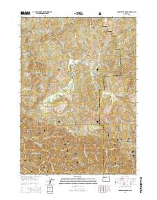
2014 Map of Barklow Mountain
USGS Topo · Published 2014About this map
Siskiyou National Forest dominates this section of the Oregon Coast Range, where the complex drainage systems of the Sixes River and its various forks define the topography. The terrain is marked by high summits including Barklow Mountain and Salmon Mtn, falling away into deep drainages like Murphy Canyon and Fuzzy Gulch. Human presence is concentrated along primitive forest development roads, with historic sites like the Haines Cem and Huckleberry Knoll Cem providing evidence of early homesteading or forestry activity in these high basins. The map illustrates the convergence of Curry and Coos counties across a landscape of high-elevation flats, including Thompson Flat and Ash Flat, and named ridges such as Camp Five Ridge. This 2014 survey documents the modern boundaries and access routes of the Middle Fork Sixes River and its tributaries before they reach the Pacific coast.
Find a feature on this map
53 named features on this map. Tap any name to fly to it.
Don’t see what you’re looking for? This feature index may not catch every label — zoom into the map to look around manually.
Map Details
Editions of this 2014 Barklow Mountain Map
This is the sole edition of this map. No revisions or reprints were ever made.
Other maps of this area

1899 · Port Orford
USGS Topo · 1:125,000

1903 · Port Orford
USGS Topo · 1:125,000

1954 · Coos Bay
USGS Topo · 1:250,000

1954 · Port Orford
USGS Topo · 1:62,500

1954 · Agness
USGS Topo · 1:62,500

1954 · Powers
USGS Topo · 1:62,500

1954 · Langlois
USGS Topo · 1:62,500

1958 · Coos Bay
USGS Topo · 1:250,000

1962 · Coos Bay
USGS Topo · 1:250,000
1985 · Calf Ranch Mtn
USGS Topo · 1:24,000