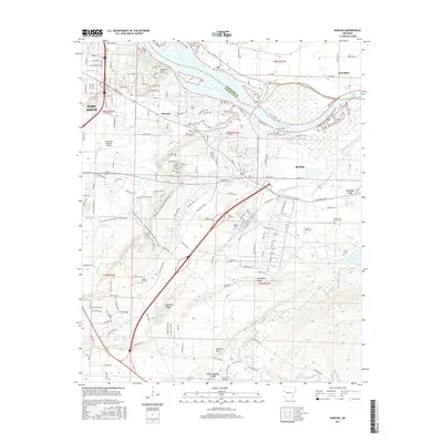
2017 Map of Barling
USGS Topo · Published 2017About this map
Fort Smith and its eastern suburbs are documented in this 2017 survey, revealing a landscape defined by the winding Arkansas River and the expanding infrastructure of Sebastian Co. The area around Barling and Massard shows a dense network of residential streets and recreational corridors, such as the Ben Geren Mountain Bike Trail System and the Ben Geren Paved Path. Genealogists will find a significant concentration of local burial grounds, including the Bartling Cem, Laura A Nolan Cem, and the White and Shelby Cem, reflecting the deep family roots in this river-valley region. Significant topographical landmarks like Wildcat Mtn and Donahoe Ridge rise above the drainage of Massard Creek and Little Vache Grasse Cr, providing a clear view of the natural relief that has shaped development in the Fort Smith Regional Airport vicinity.
Find a feature on this map
104 named features on this map. Tap any name to fly to it.
Don’t see what you’re looking for? This feature index may not catch every label — zoom into the map to look around manually.
Map Details
Editions of this 2017 Barling Map
This is the sole edition of this map. No revisions or reprints were ever made.
Other maps of this area

1879 · Fort Smith
USGS Topo · 1:62,500

1887 · Van Buren
USGS Topo · 1:62,500

1887 · Greenwood
USGS Topo · 1:62,500

1890 · Fort Smith
USGS Topo · 1:125,000

1906 · Lavaca
USGS Topo · 1:62,500

1906 · Barber
USGS Topo · 1:62,500

1943 · Fort Smith
USGS Topo · 1:125,000

1946 · Fort Smith
USGS Topo · 1:250,000

1947 · Lavaca
USGS Topo · 1:62,500

1947 · Van Buren
USGS Topo · 1:62,500