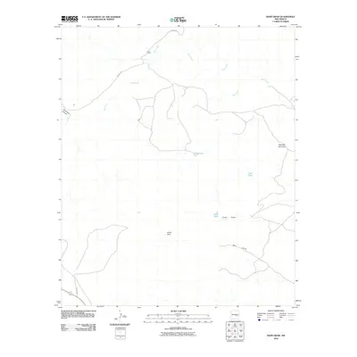
2010 Map of Barn Draw
USGS Topo · Published 2010About this map
Corn Ranch serves as a lone point of settlement in this arid corner of Chaves County, situated at a junction near the upper reaches of Salt Creek. The landscape is defined by its drainages and water management, with the namesake Barn Draw and Camp Draw carving through the terrain towards the southeast. Strategic water features like Hub Tank, Ned Tank, and Todd Tank emphasize the ranching requirements of the region, where every catch-basin is critical for livestock. Topographical landmarks such as Haystack Mountain and the distinctively named Devils Hole provide orientation in an area marked by wide stretches of open land and intermittent canyons like Rock Tank Canyon. The network of local roads, including Verbana Rd and Draper Rd, provides the primary access through this sparsely populated New Mexican rangeland.
Find a feature on this map
12 named features on this map. Tap any name to fly to it.
Don’t see what you’re looking for? This feature index may not catch every label — zoom into the map to look around manually.
Map Details
Editions of this 2010 Barn Draw Map
This is the sole edition of this map. No revisions or reprints were ever made.
Other maps of this area

1949 · Roswell North
USGS Topo · 1:24,000

1949 · Corn Ranch
USGS Topo · 1:24,000

1950 · Corn Ranch
USGS Topo · 1:24,000

1955 · Roswell
USGS Topo · 1:250,000

1958 · Roswell
USGS Topo · 1:250,000

1962 · Roswell
USGS Topo · 1:250,000
1962 · Roswell North
USGS Topo · 1:24,000

1962 · Horseshoe Bend
USGS Topo · 1:62,500

1962 · Rock House Canyon
USGS Topo · 1:24,000

1962 · Panther Hill
USGS Topo · 1:24,000