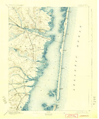
1898 Map of Barnegat
USGS Topo · Published 1924About this map
Barnegat Bay dominates this coastal landscape, separated from the Atlantic Ocean by the narrow ribbon of Island Beach. At the southern tip of this barrier island, Barnegat Light stands sentinel over the treacherous Barnegat Inlet. The late nineteenth-century economy is visible in the complex rail network, including the Philadelphia and Long Branch Railroad crossing the bay to reach emerging seaside resorts like Seaside Park, Lavallette, and Chadwick. Inland, the map captures the transition from cedar swamps and tidal creeks to established mainland settlements. Significant infrastructure such as the Toms River and Waretown Branch and the Tuckerton Railroad connect towns like Barnegat, Waretown, and Forked River, providing insight into the timber and maritime transport routes of the era before coastal development reached its modern density.
Find a feature on this map
51 named features on this map. Tap any name to fly to it.
Don’t see what you’re looking for? This feature index may not catch every label — zoom into the map to look around manually.
Map Details
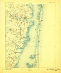
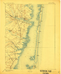
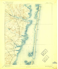
Editions of this 1898 Barnegat Map
5 editions found

Other maps of this area

1884 · Whitings
USGS Topo · 1:62,500

1888 · Barnegat
USGS Topo · 1:62,500

1888 · Little Egg Harbor
USGS Topo · 1:62,500

1888 · Asbury Park
USGS Topo · 1:62,500

1888 · Cassville
USGS Topo · 1:62,500

1888 · Long Beach
USGS Topo · 1:62,500

1888 · Whitings
USGS Topo · 1:62,500

1893 · Little Egg Harbor
USGS Topo · 1:62,500

1893 · Asbury Park
USGS Topo · 1:62,500

1893 · Long Beach
USGS Topo · 1:62,500