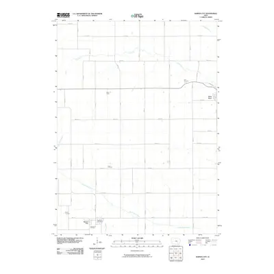
2010 Map of Barnes City
USGS Topo · Published 2010About this map
Barnes City and the town of Deep River anchor this rural Poweshiek County landscape in the early 21st century. The terrain is defined by the winding course of the South English River in the south and the Deep River watercourse further north, alongside smaller tributaries like Jordan Creek and Pleasant Creek. These waterways dictate the subtle variations in the agricultural grid, which is otherwise dominated by named roads like Barnes City Rd and V18 Rd. Genealogists will find a cluster of significant burial sites, including the Barnes City Cemetery, Lisor Cemetery, Light Cemetery, and Harper Cemetery, scattered throughout the farming country. The civic heart of the southern settlement is centered on the Barnes City Post Office, while the inclusion of East Field marks local landmarks within the broader township structure.
Find a feature on this map
39 named features on this map. Tap any name to fly to it.
Don’t see what you’re looking for? This feature index may not catch every label — zoom into the map to look around manually.
Map Details
Editions of this 2010 Barnes City Map
This is the sole edition of this map. No revisions or reprints were ever made.
Other maps of this area

1954 · Des Moines
USGS Topo · 1:250,000

1956 · Des Moines
USGS Topo · 1:250,000

1957 · Des Moines
USGS Topo · 1:250,000

1965 · Gibson
USGS Topo · 1:24,000

1965 · What Cheer
USGS Topo · 1:24,000

1968 · Deep River
USGS Topo · 1:24,000

1968 · Brooklyn
USGS Topo · 1:24,000

1968 · Victor
USGS Topo · 1:24,000

1968 · Barnes City
USGS Topo · 1:24,000

1969 · Des Moines
USGS Topo · 1:250,000